
-
×
 14ers Series Elk Mountains Map Pack
1 × $10.95
14ers Series Elk Mountains Map Pack
1 × $10.95


Our Colorado trail map collection includes 45 detailed topographic maps, covering all 58 iconic 14er peaks, 28 remote Wilderness areas, National Forests, National Parks and more. Built to handle trail conditions, our rugged maps are trusted by hikers, backpackers, equestrians, and hunters for adventures short or long.
The Hiker’s Map of Colorado is a 27”x39” wall poster map of the entire state of Colorado with public lands, hiking trails and more.
Explore our Colorado maps below and find the perfect map for your next adventure.


Featuring:
Use our Colorado Trail and Map Finder tool below to explore the hiking areas and trails to find your next outdoor adventure.
Choose how you want to search: by public lands, 14ers, topo maps coverage or just browsing. Select results on the map you’d like to know more about!


Click on the map of Colorado to open a larger version.
This map shows the names and areas covered of each map in the Colorado 14ers Map Series.
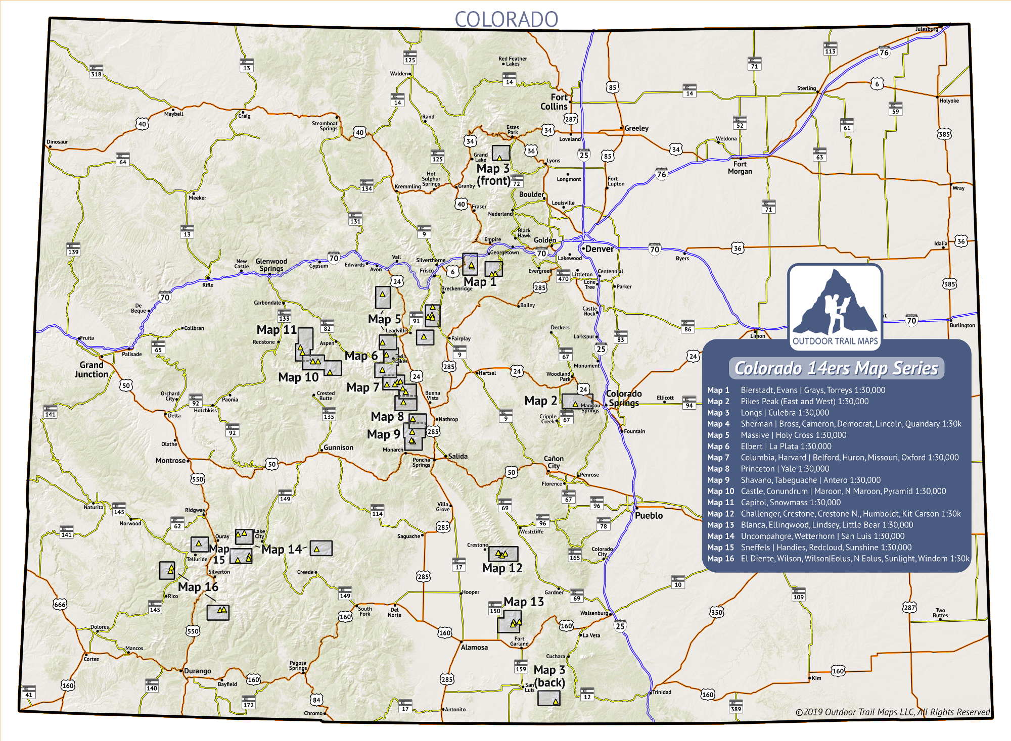

Colorado 14ers Series Maps
14ers Map 10 of 16: Castle, Conundrum | Maroon, North Maroon, Pyramid


Colorado 14ers Series Maps
14ers Map 12 of 16: Challenger, Crestone, Crestone Needle, Humboldt, Kit Carson


Colorado 14ers Series Maps
14ers Map 16 of 16: El Diente, Wilson, Wilson | Eolus, North Eolus, Sunlight, Windom


Colorado 14ers Series Maps
14ers Map 4 of 16: Sherman | Bross, Cameron, Democrat, Lincoln, Quandary


Colorado 14ers Series Maps
14ers Map 7 of 16: Columbia, Harvard | Belford, Huron, Missouri, Oxford


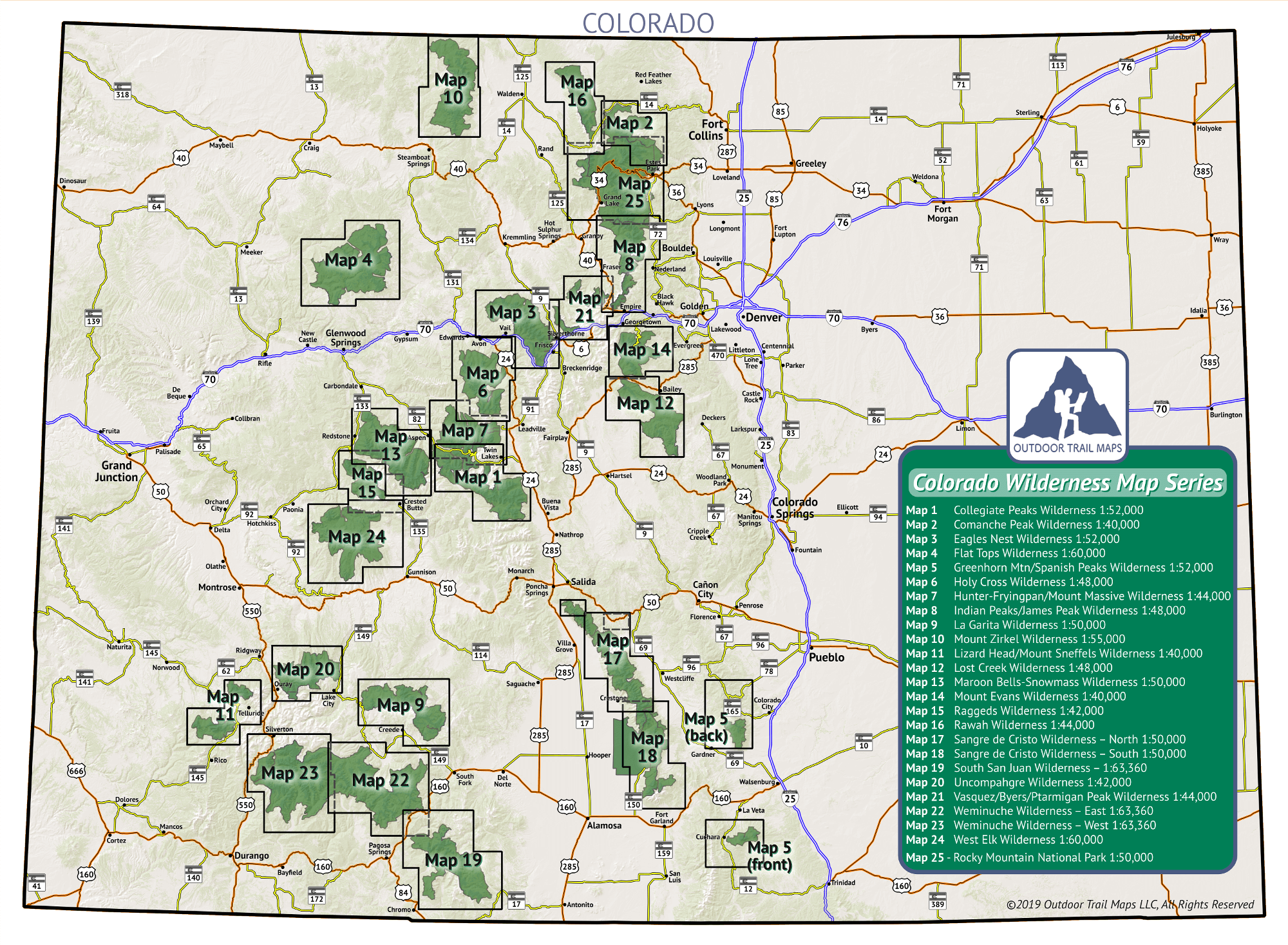
Click on the map of Colorado to open a larger version.
This map shows the names and areas covered of each map in the Colorado Wilderness Map Series.


CO Wilderness Series Map Packs
Colorado Wilderness Series Vol 1 and Rocky Mountain National Park


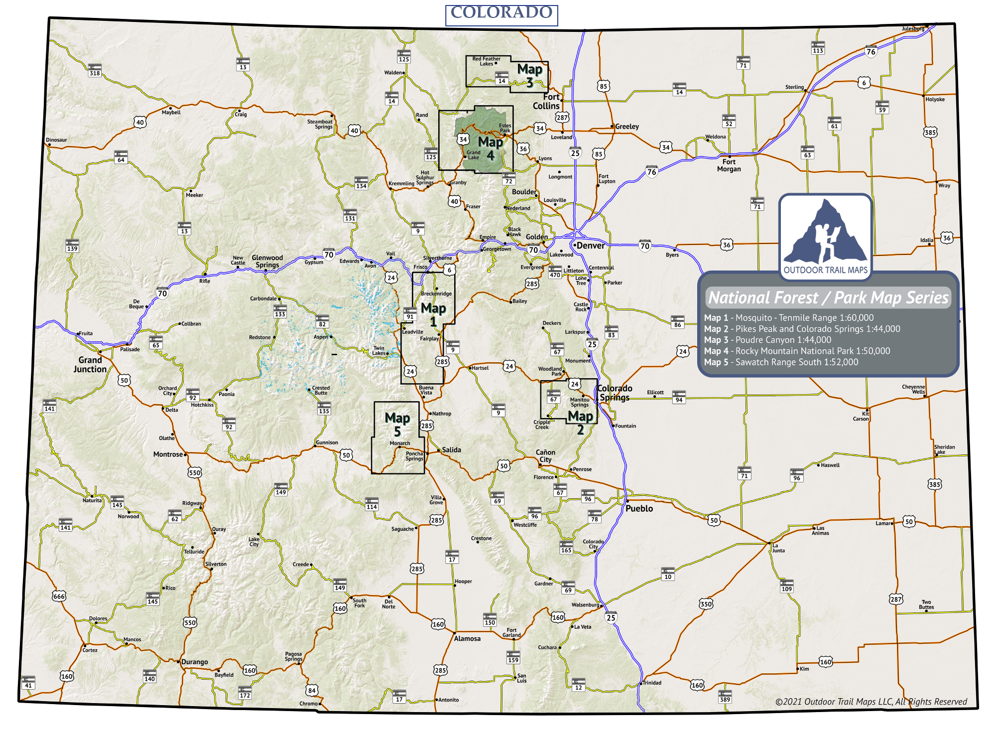
Click on the map of Colorado to open a larger version.
This map shows the names and areas covered of each map in the Colorado National Parks / Forest Map Series.


Formed in 1994, Colorado Fourteeners Initiative began as a partnership of nonprofit organizations, concerned individuals and public agencies to preserve and protect the natural integrity of Colorado’s Fourteeners after rapidly expanding recreational use.
Today, CFI is the nation’s leading high-elevation trail-building, terrain-restoration, and visitor-education organization. Check out everything they do at 14ers.org and consider helping to support their mission today.


