
Colorado |
 |
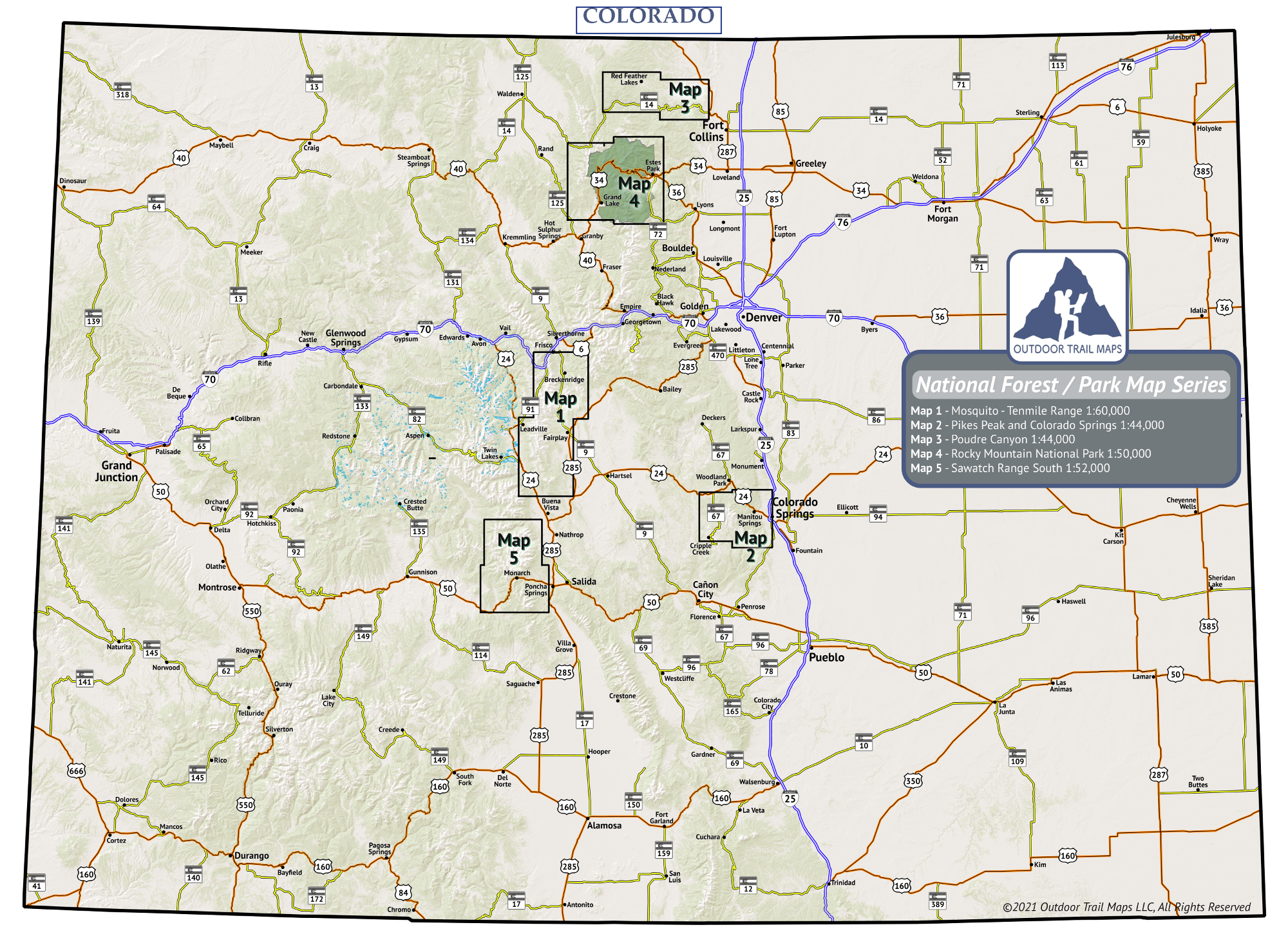
Colorado Nat'l Parks / Forest Map Series


The Colorado National Parks and National Forest Maps from Outdoor Trail Maps LLC cover popular hiking areas in Colorado National Parks and National Forests not protected by wilderness (see See Colorado Wilderness Series Map Series). Smaller, lighter and more accurate than other outdoor maps, our Colorado Maps are the key to years of Colorado exploration on foot (or saddle).
These waterproof, tear-resistant topographic hiking maps cover Rocky Mountain National Park and four other National Forest protected areas of the state, including Pikes Peak and the Poudre Canyon. Purpose-designed with hikers and backpackers in mind, these maps are:
-
Waterproof and tear-resistant – designed for on-trail use in harsh conditions
-
Smaller – only 4″ by 7″ folded
-
Lighter – less than 2 ounces
-
Accurate, intuitive and easy-to-use
Click here to visit the Outdoor Trail Maps Colorado National Parks and Forest Series Map Store
The Colorado National Parks and National Forest Map Series
Click on the map of Colorado to open a larger version.
This map shows the names and areas covered of each map in the Colorado National Parks / Forest Map Series.
Interactive Colorado National Parks and National Forest Map Finder
National Parks and National Forest Series Maps


